
 |
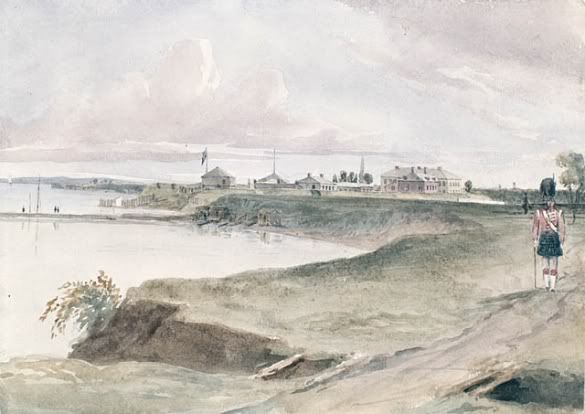
| Pier and Fort, Toronto, August 1839 Philip John Bainbridge (National Archives, C-2801) |
Being within rifle-shot of the fort, Front (or Ontario Terrace, as it was known then) and Bathurst would have seen many of the comings and goings of the soldiers housed within, particularly on their peregrinations to nearby York.
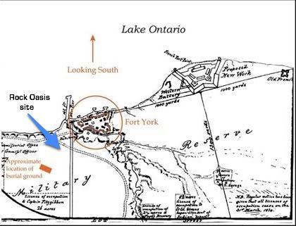 |
| Detail of a Plan of the Military Reserve, 1833 Captain RH Bonnycastle. Edith Firth, Ed., Town of York, 1815-1834, 1966 |
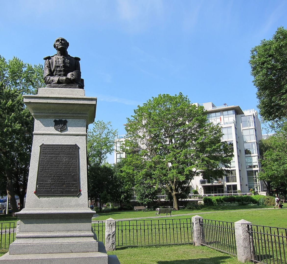 |
| Old Soldier, 1906 Victoria Square Monument by Walter Allward Twenty Niagara in background |
In 1905 the name was officially changed to 'Victoria Memorial Park' to honour the queen, who died in 1901. The Square remains extant and recently underwent extensive landscaping and memorial renovation.
| James Cane 1842 Map extract. Rock Oasis sits between Victoria Square and The Old Garrison |
Front and Bathurst sits betwixt these two key Toronto historical landmarks, both designated as part of the Fort York National Historic Site. It should be no surprise that the corner has witnessed a lot of history.
The Hon. Peter Robinson purchases the lot in 1833 for £605
As mentioned above, the area immediately surrounding Fort York was part of the Garrison Reserve -- it was not until 1833 when Lieutenant Governor Sir John Colborne began placing numerous lots of the former Reserve up for sale, hoping to fund construction of a ‘New Fort’ (the existing Fort was seen as inadequate due to size and other factors) and to accommodate the expansion of burgeoning York to the east.
In the 1834 York Commercial Directory, Street Guide and Register by George Walton, the last entry on Front St. W. prior to the Garrison is the “Hon. Peter Robinson, Commissioner for the sale and management of Crown Lands and Clergy Reserves; Surveyor General of Woods and Forests”.
Sitting on the Legislative and Executive councils of Upper Canada, Robinson was appointed the task of disposing of crown properties, typically through auction, with the aim of encouraging immigration. His brother was Sir John Beverley Robinson, 1st Baronet, chief justice of the Court of King’s Bench.
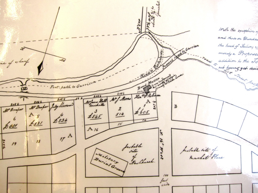 |
| 1833 Proposed Sketch by Deputy Surveyor Henry James Castle shows the north east Front and Bathurst lot (labelled A1) as having been sold to the Hon. Peter Robinson for the princely sum of £605 |
Walton’s 1837 directory lists Robinson on Front Street, but doesn’t indicate a specific location -- it’s unclear whether this meant the lot he purchased, or a house further east on Front nearer to Toronto. [A list of Robinson’s extensive holdings in 1837 recorded more than 7,592 acres and several additional properties in Toronto.]
Robinson passed away in 1838. His brother John Robinson then sold a portion of that lot to James Hickman, who proceeded to construct a longstanding tavern known as the Rescue Inn.
Read the next section: